South Island
In this brief trip to the South Island, we were unable to do many things we had hoped to do. Instead, we discovered interesting local history and people who have endured disastrous events and have shown amazing resilience and determination to make things better after life-altering setbacks. For us, this was the type of divergent twist that makes us feel that the unplanned is often better than the planned, touristy travel that most people experience.
For readers new to our blog, click here.
For those of you that are reading one of our blogs for the first time, the blog is called “Fridaes’ Adventures,” obvious enough, but we added an explanatory subtitle of “People First.” This calls out our tendency to be more interested in the people we meet than the places we go. We try to get to know the people first and let them teach us about the landmarks, the food, and the culture. The magic is hardly ever planned, but for us it unfolds usually when we find something or meet someone unexpected: serendipity. A great day is one in which we had nothing planned, or when we abandon a plan because somebody tells us about a more interesting place to see or an activity to do, and it often turns out better than anything we could have planned.
We travel primarily using Airbnb. One reason is that there is a simple tool you can use on the website to communicate with your hosts before you make an arrangement to stay. (Some people might call this a “hack,” but it’s just a friendly way to talk with your potential hosts before you agree to rent.) We often tell our hosts that we keep a blog and would like to get to know them as a part of our stay. Some hosts are very willing but some tell us that they’re busy, don’t have the time, or maybe that it’s just a business and that they don’t even live onsite. That is fine for us if we’re not interested in writing about that town or place. But often, we want to investigate a place, and they’re is no better place to start learning than with a willing host. And when a host is interested in us, and willing to open up, that makes for a brilliant start! In this blog, we met a couple of hosts who were very willing to share generously! And we reconnected with some old friends who used to live in our hometown of Winters.
Rebecca’s writing is entered in italics, like this, and mine is in normal text like this. She usually does the hard work of recording people and place names, and she often lists the food we eat. She works tirelessly putting down information in her journal before we forget it, and we often sit around at night recalling the events of the day. For my part, I often try to research the place a bit and throw in some history and analysis. We record them this way so you get a bit of our unique voices.
Also, our trips are recorded here on this blog, newest posts at the top. So if you’re following longer, multi-part story, you might need to scroll down to find the beginning of it. Happy reading. We love to hear from our readers in the comment section below. Tell us if any of this is interesting or if you’ve had similar experiences. And please subscribe and share on social media. If you subscribe you’ll receive an email when we post a new blog, and that’s only a few times a year, at best. Thanks for coming along!

We ended our stay in New Zealand with a quick trip to the South Island. We flew from Wellington to Christchurch, on the east coast of the South Island. The South Island it larger, but much less populated than the North Island. Some of the most rugged and iconic New Zealander landscape is found there. We looked forward to seeing the amazing glacier mountains and lakes, maybe going out on a boat adventure to see sea life, or maybe going on a train ride to the west coast, but we had only six days to squeeze in a lot to do.
Before flying down, we looked up some information about our primary destination, Christchurch, a seaport on the east coast of the island. Click here to read more of the history, if that interests you:
The first people in this area of the South Island were known as “moa hunters,” arriving approximately a thousand years ago. They lived off this large, flightless bird for about 200 years After they had exhausted the moa, the Ngāi tribe arrived and took control of the coast. This became a major trading center for pounamu or greenstone.
The seemingly omnipresent Captain James Cook made the first European sighting of area called Waitaha. He thought it was an island, and named it Banks Island after the ship’s botanist, Joseph Banks. Later, it became known as Cantebury Penninsula, named after this political region.
But it was 1815 when sailors from the sealing ship Governor Bligh and Europeans first set foot on Banks Peninsula. During the 1820s and 1830s the local Māori population fell. Like so many other places where Europeans explored, it was guns and germs that conquered them, as Jared Diamond has explained. The port of Lyttleton was developed as a trade and whaling port, and from there, European dominated this part of the South Island. Cattle and goats were imported, farming was introduced and by 1850, the area was looking a lot like a British colony.
Early colonists, John Godley and Edward Wakefield decided in 1947 to organize a planned community before settlers arrived. There would be farmers, trained workers, and it would have churches, shops, and schools. They named the region Canterbury, after Godley’s alma mater, and the town Christchurch after Wakefield’s previous college. The scheme gave potential settlers the opportunity to buy land, and this gave the organizers money to pay the Maori for the land. But first they had to make an agreement with the native Maori. They kept some of the land for community places like parks, churches, and “food gathering places.” There was an agreement signed by 16 local Ngāi Tahu leaders and £2,000 paid to them. It all seemed copasetic, like a win-win for everyone.
But, as always seems to happen in these circumstances, those with the written language and the superior technology, some sort of fudging happened after the agreement was made. The map attached to the agreement was changed, the wording of “10 acres for each Ngāi” member became three, and so forth. The settlers gradually dominated those who were already here by means that were not above board, it seems. The founders, doing what seemed to be the prosperous and responsible things to establish a new civilization, gained wealth and notoriety.
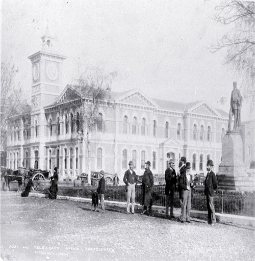
Cathedral Square, showing the Post Office and Godley statue [ca. 1882], CCL PhotoCD 1, IMG0054
Two other towns were planned as a part of the Canterbury plan. Lyttleton was the port city at the mouth of a deep channel to make it safe for large ships to dock. And Sumner was a place midway between Christchurch and Lyttleton, and a convenient place to house whaling and dock workers and those who transported the goods from the harbor to the bigger, developing city of Christchurch. Lyttleton is surrounded by some steep, treacherous hills, and the first leg to Sumner was steep and windy. So eventually a train tunnel was built and bypassed Sumner. Nowadays, Sumner is a vacation town with lovely sea views and lots of restaurants and hotels, and Lyttleton continues to serve as a harbor, for both freight and cruise ships.
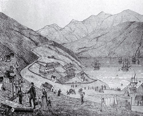
Port Lyttelton, showing the first four ships and emigrants landing from the Cressy [28 Dec. 1850]
A train tunnel to provide access directly to Christchurch was begun in 1860 and finished in just six short years. The two ends of the tunnel met in the middle, completing a 2.6 kilometer tunnel, an amazing feat for mid Nineteenth Century. Even though it has been widened, strengthened, and modified to handle both cars and trains, it remains the longest tunnel in New Zealand.
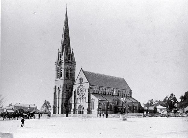
Cathedral, Cathedral Square [ca. 1888] CCL PhotoCD 1, IMG0048
Christchurch became an official City by Royal Charter in 1856 and was recognized by the Anglican Church as an “English See.” Since the Anglican Church had made this an official “seat” of religious governance and sent an archbishop to direct the affairs. Soon, plans for a grand cathedral were drawn up. The Christchurch Cathedral was started during our Civil War and was not completed until 1904.
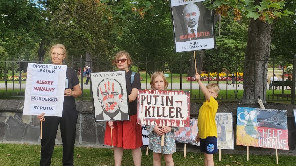
Christchurch has become the largest city on the South Island, and is the second largest in New Zealand, larger than the capital city, Wellington. Christchurch has endured fires, earthquakes and a vicious mass murder in recent years, but it seems to come back stronger each time.
The Neighborhood where we stayed.
On the flight over, we got a hint that Christchurch seems to always be coping with some sort of disaster. I looked out my window and saw a plume of smoke to the south east of the city. I pointed it out to our flight attendant and she said, “That must have just started. It looks like it’s near the tunnel.” It turns out that it was near the Airbnb where we were staying as well. Later, I heard on a radio station that the fire officials were seeking photos of the fire in its early stages, so I went online and submitted this photo. I never heard if it was of any use.

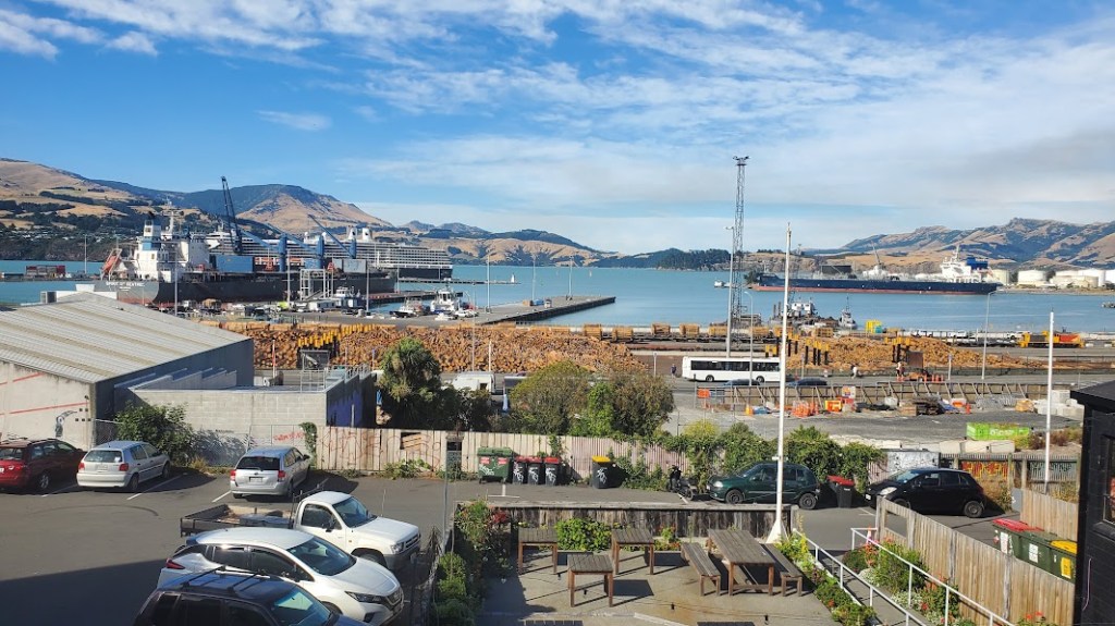
I was just taking some photos from the air as we approached the Christchurch airport when I saw this plume of smoke. It turns out that the fire had just started and would continue to burn for three days after we landed. It was near where we stayed, but did not affect us in any way. Lyttelton can be seen just beyond the hill on the Lyttelton Bay. We would learn about the importance of this port as we got to know the history of the Canterbury region.
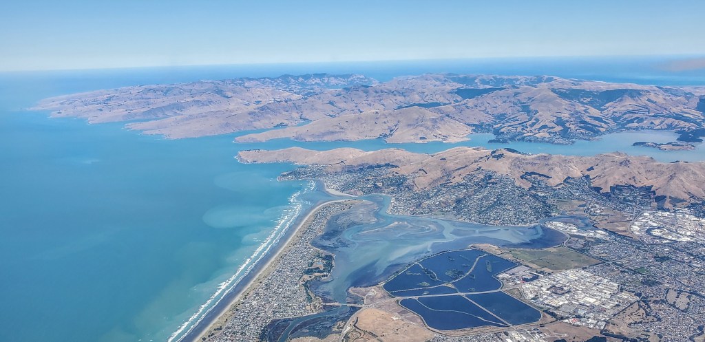
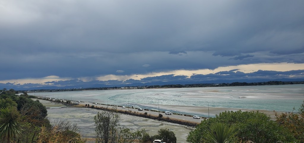
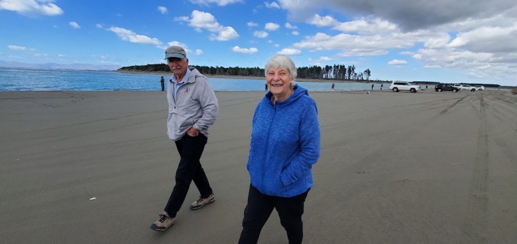
Although we did not know it at the time, our Airbnb location was nearly dead center in this photo. The long, straight beach ends in an a triangular inlet into the Sumner bay. Our place was on a hill overlooking that bay. It was a very nice place to stay, but getting into Christchurch (outside to the right and below this photo) involved walking down a steep drive and taking a 25 minute bus ride.
We took a bus into the city center and switched to the one that took us to Redcliff where our place is. We didn’t realize how far out of town it was, but the bus will take us back into town easily, Our place is up a steep road. It is a tiny cottage behind a large expensive-looking house. We are surrounded by hedges, so it is very private, but we don’t get the view of the bay. Chloe, a woman in her late 30’s? is our host. It’s clean and neat, with a very small bathroom. It has everything we need, but there is no washing machine.
We settled in, and rested for a bit before we called an Uber to take us to the seaside town of Sumner for dinner. We went to the Beach House restaurant, and it was very busy because it was Valentine’s Day. We ordered drinks; I had a Hugo and Woody had a margarita. We ordered small plates– a salad to share and Woody had tacos and I had an eggplant bruschetta.
We had a great dinner at the Beach House, right on the shore. Even though it was crowded and noisy, the atmosphere was cheerful and we talked to a few other guests while we waited for our food. Afterwards, we walked around Sumner for a bit, looking for a famous ice cream shop someone told us about. It was so famous that it had a line going out and down the street. We decided to duck into a quieter cafe to share some ice cream and cake to celebrate Valentine’s Day.
The next morning, our bright, cheerful host, Chloe, took us for a little orientation drive around the area of Sumner and then to the port city of Lyttelton for coffee. She told us that Lyttleton played in important part in the development of Christchurch and the entire region of Canterbury. It was the port city that made it possible for big ships to bring cargo and passengers here in the 1800’s.
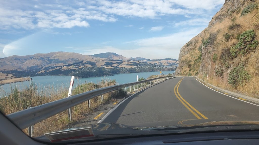
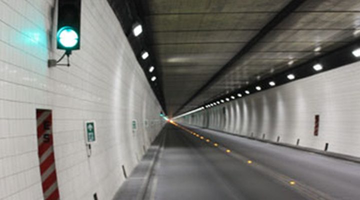
Our Airbnb host, Chole, took us for a quick drive from her beautiful home on Redcliff hills, through Sumner, over the twisty road to Lyttelton where we explored some of the touristy spots that cater to the cruise ships that dock nearby. Then we returned through the Lyttelton Tunnel that goes directly back to Christchurch.

The coffee shop was another of these modern industrial themed places with their coffee roaster taking up a bit of space. We sat out back and watched the port activity below us. Truckloads of logs were being loaded onto a ship and behind that, a huge cruise ship sat waiting for its passengers. We talked about the fire, her two kids–a baby and a two-year-old.
Chloe took us back through the Lyttelton tunnel. This tunnel is still the longest tunnel in New Zealand. The rail tunnel was instrumental in the founding and development of Christchurch. The automobile tunnel, opened in 1964, is more of a convenience nowadays.
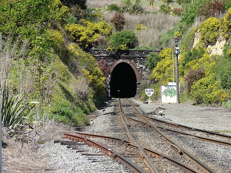
The second tunnel was opened in 1964. Later on, our Rotary friend, Deryn, would tell us from memory about the day it opened. “The day it was opened it was closed to traffic and only open for pedestrians. Thousands of us walked through. I and my sisters had been at a Girl Guide event but didn’t have time to go home to get changed so walked it in our guide uniform.” For locals, the tunnel is a big deal.
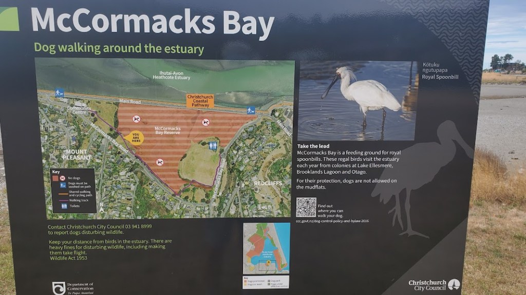
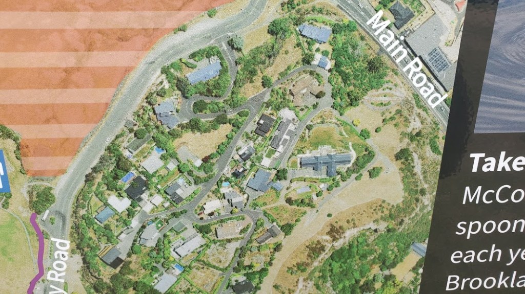
Later that day, we explored the area around Redcliff where our Airbnb rental is, and we walked down the steep drive to look for a place to eat. Below the housing was a dried up bay called McCormack’s Bay. I think it’s actually an estuary that is sometimes wetlands, but now was dried out somewhat due to lack of rain. There has been a restoration program going on for some years, and signs posted showed photos of the spoonbills they are trying to conserve.
Trip to See Glaciers
The one planned trip we had booked before coming to the South Island was a guided tour by bus to see Mt. Cook and some glacier lakes southwest of Christchurch. We had to get into town by 8am, so we were out of the cottage, hiking down to the bus stop by 7am.
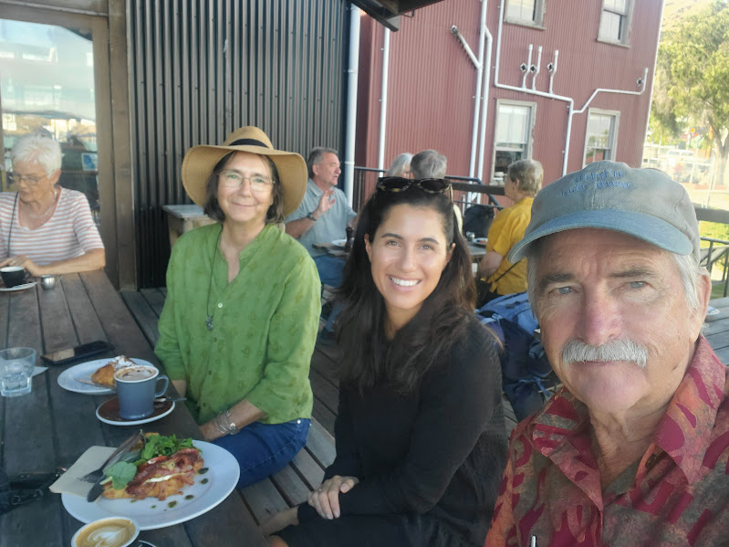
We met our tour group near the main terminal in Christchurch. There was a friendly young woman from Scotland named Erin that we met and liked immediately. The bus was a smaller bus, maybe 25 passengers and a driver/tour guide.
We sat in the second to last row and off we went. The drive to the glacier was over four hours away, but there were some other stops on the way. We stopped at a small town called Geraldine for a bathroom break and coffee. Woody didn’t want to buy the expensive coffee, so we just went into Subway (they are all over here, too). I found some post cards at a tourist shop that focused on wool- Merino, alpaca, and oddly–opossum! They said that opossum fur added depth and so made things dry quicker.
Our next stop was Lake Takepo which is a glacier fed lake. Under sunny circumstances, is is an incredible blue, according to our guide. But it was kind of blue/white today. The blue is from the white volcanic dust that the glacier scrapes off the mountain as the glacier retreats. It is suspended in the water and it reflects the sky. As the sun came out, the water became bluer.
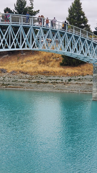
There is a new pedestrian bridge we crossed that leads to a church that was built in the 1860s on the shore out of local stone. As it turns out, my sister-in-law and her husband had visited this very church nearly 20 years ago.

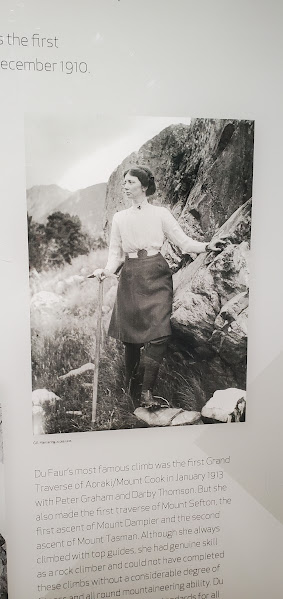
We stopped at the Hermitage Hotel, an expensive resort at the beginning of the trailhead to Mt. Cook. It is for people doing serious trekking up the mountain. Nearby was a visitor center called the Edmund Hillary Alpine Center. Hillary was from New Zealand and would practice his climbs here. We walked to the visitor center and looked around. It was impressive to see two women mountain climbers from the turn of the last century and the clothes they wore. One climbed the summit in a dress and the other had pants under a shorter dress (in those days).
Freda du Faur became the first female climber to ascend Aoraki (Mt. Cook) doing it in record time.
Du Faur had begun working towards this achievement two years earlier in 1908. Interested in climbing as a youngster in Australia, she was inspired by photos of the Southern Alps to try mountaineering, and trained with the Hermitage’s chief guide, Peter Graham. For three months before the attempt, du Faur also trained under Muriel Cadogan at the Dupain Institute of Physical Education in Sydney. She finallly made the summit in 1910. Wikipedia
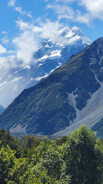
During the day, it was overcast and we were afraid that we would never get a glimpse of Aoraki (Mt. Cook). In the Hillary information center, the sun broke through, and I was able to get this photo of the mountain from the observation deck.
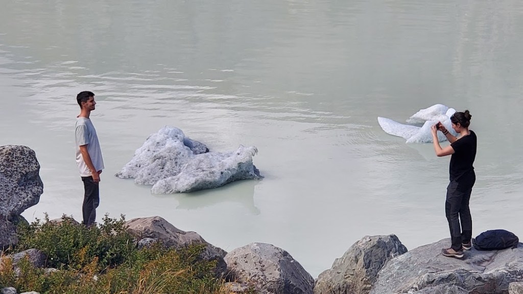
We finally made it to Lake Pukaki, a lake that has glacier bits floating in it, but first we had to climb 350 steps up to the rim of the lake. We were disappointed with the glaciers we did see. First of all, the glaciers were calving off on the far side of the lake, some 5km away. Secondly, the little bits of glaciers that did make it to the downstream side of the lake were little more than ice cubes. Our guide told us that at one time, the point of land where the glaciers used to be was on this side of the lake, calving off near the road, and that only a decade ago, people could see the glaciers without leaving their cars. Now they have receded way back.
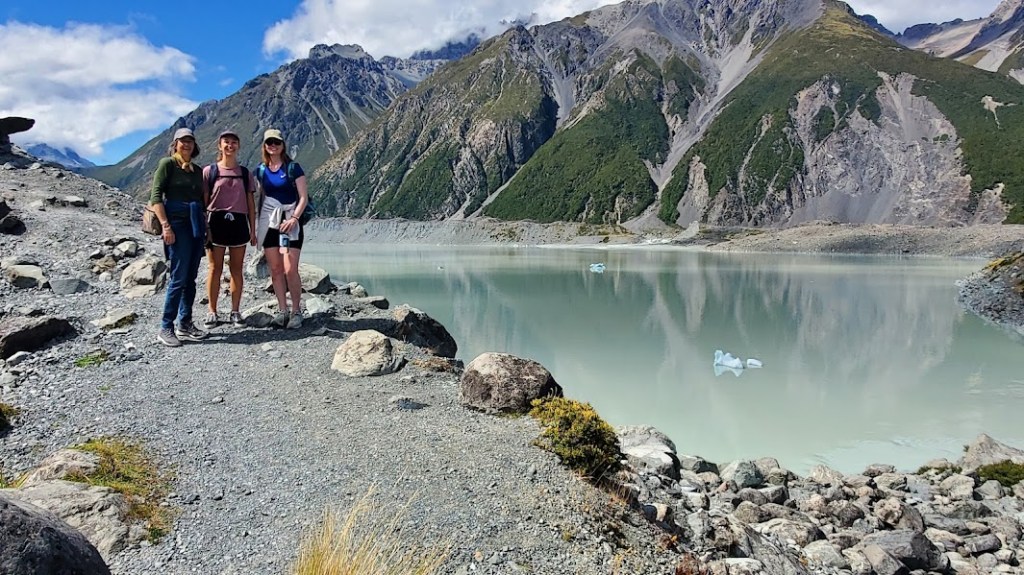
It was tiring and we had to stop a few times going up the steps. It was amazing to see Erin and Angela become friends and practically dance up the stairs. Oh, to be young and strong and have good balance!
Up at the top, you could look over toward the glaciers. My first feeling was disappointment, as it was so far away and not white and shiny, but covered in a layer of soil. But you could see the edge where it was breaking off into the lake and above it you could see it stretching back up the mountainside where it did appear white. We could see Aoraki (or Mt. Cook) and other glacier covered mountains.
Back late in Christchurch at the bus drop-off, we exchanged contact information with Erin and Angela and traded some photos. Maybe we will see them again someday?
The Earthquakes of Christchurch–2010 and 2011
We typically try to start off a new city soon after we arrive by doing a tour with Guru Tours, or Free Walking Tours. These tours are not really free. The ask that you pay whatever you think the tour is worth, and they are usually a very good way to get to know some basics about history and have local tips for restaurants or must-see places to visit. But since we had already been in Christchurch for a few days, it seemed that we weren’t as green as we usually are when we take this type of tour. We always seem to get there early (as they suggest) and then wait for late-comers to show up.
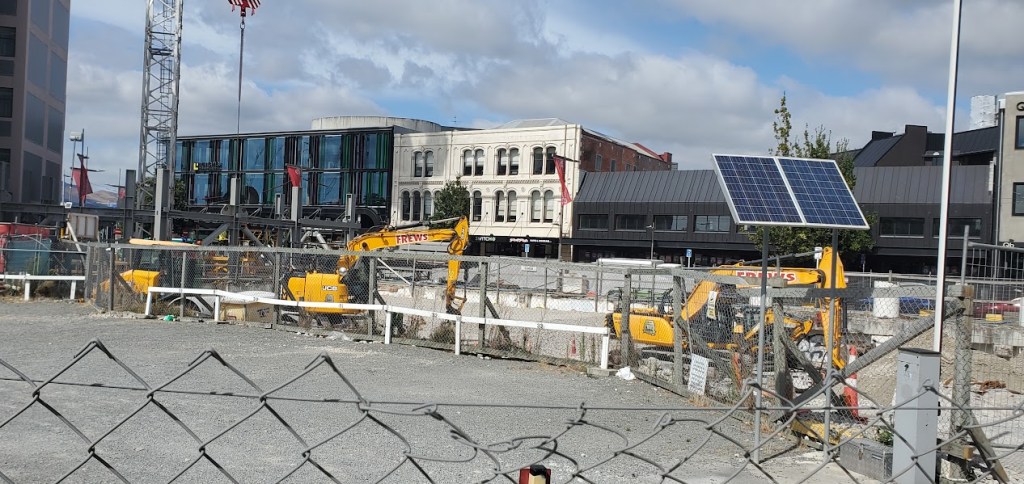
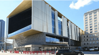
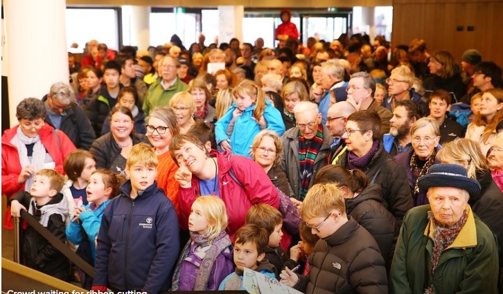
This tour was a large group, maybe 30 people. Our guide, James, was quite tall, I think about 6′ 6″ or so, so he was easy to spot walking through the crowds. Almost immediately, the theme of recent earthquakes and how the city has recovered became prominent. Everything he pointed out was either something that was destroyed or something that was in the process of becoming better through the recovery project. A huge convention center was recently opened in Cathedral Square where several buildings had been razed. A new and thoroughly modern library had replaced the one that was damaged in the earthquake. The Cathedral itself was in a major rebuilding reissuance since it’s partial collapse. One of his recommendations to visit after the tour? The Earthquake museum!


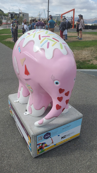

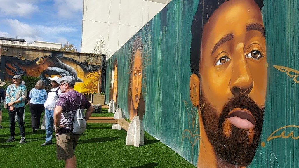

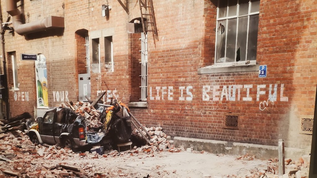
Artwork has been sponsored by the Recovery Committee. Murals are everywhere and these elaborately painted elephants are ubiquitous. They have paid local artists to produce artwork, some of which is to be sold off at auctions later, all to support the recovery effort and provide a light-hearted atmosphere downtown.
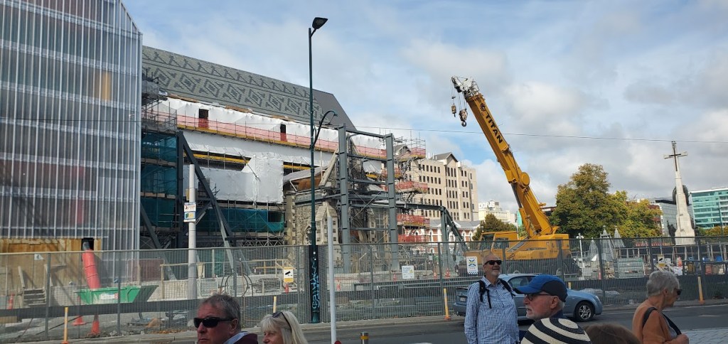
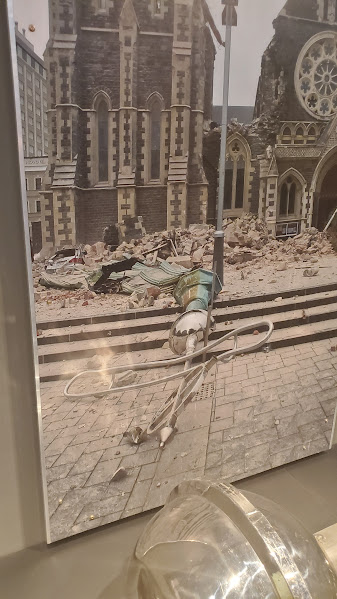
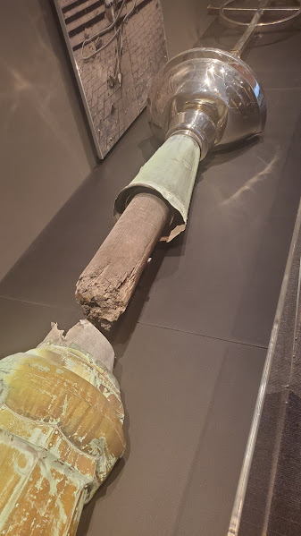
He walked us through the city pointing out buildings that were being rebuilt. We were in Cathedral Square where we saw that many buildings had to be demolished. After years of debate, they did decide to rebuild the cathedral and are in the process of doing so. The post Office survived, but they’ve built a new convention center. Only one building completely collapsed during the earthquake, accounting for most of the deaths that day–but many of the buildings were structurally ruined by liquefaction–the process that pushes water, sand, and mud up through the ground, and then the ground sinks because of the gap it causes.
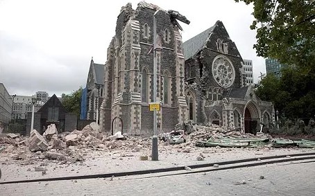


The Canterbury Cathedral was surrounded by a big fence, so I couldn’t get a good picture of it. These photos, found on Wikipedia show how it looked, left to right, before the earthquake, just after the quake, and the state of reconstruction now.
After we saw the fenced-off reconstruction project, James took us to see the “Cardboard Cathedral.” The archdiocese of Canterbury scrambled to provide a place for church members could continue to congregate, so they hired Japanese innovative architect, Shigeru Ban who promised it could be completed in less than a year.
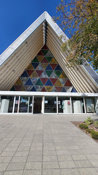
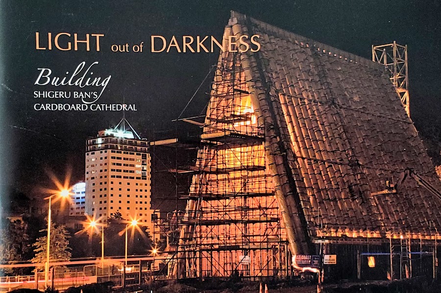

This church was built in the aftermath of the earthquake as was nicknamed “The Cardboard Church” because the infrastructure was made of giant cardboard tubes. The formal name of it is Transitional Cathedral and was built to provide a place for people to congregate after the collapse of the Cathedral until the completion of the project. It also used freight containers as meeting rooms and stabilization around the base. The middle picture was from a commemorative booklet sold in the giftshop at the entrance.
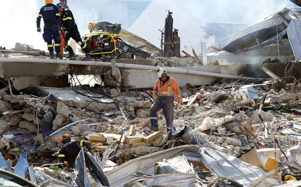
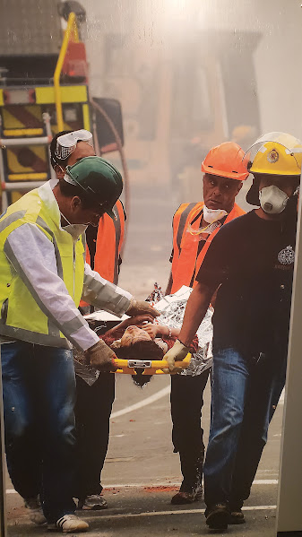
We saw the site of the Canterbury Television station building. It suffered a dramatic collapse at 12:51 pm on February 22, 2011. This catastrophic failure accounted for 60% of the deaths caused by the earthquake. This was the second but far worse earthquake in a five month period. The quake that struck in September in 2010 was actually much stronger, but because the epicenter was deeper and not centered in the city, it caused much less damage than the aftershock the following February.
In a different part of the city, we saw a memorial wall built along a peaceful stretch of the Avon where all 185 names of earthquake victims are listed.
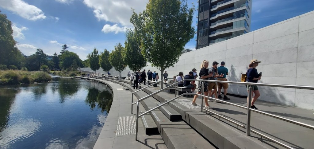
At the end of our tour, we were sort of “earthquaked out.” It was pertinent to the recent history of Christchurch, but we had seen so much related to the Earthquake. Although James had suggested that we follow up his tour with a tour of the Earthquake Museum, we decided to take him up on a closer and more copesetic site, the Botanical Garden.
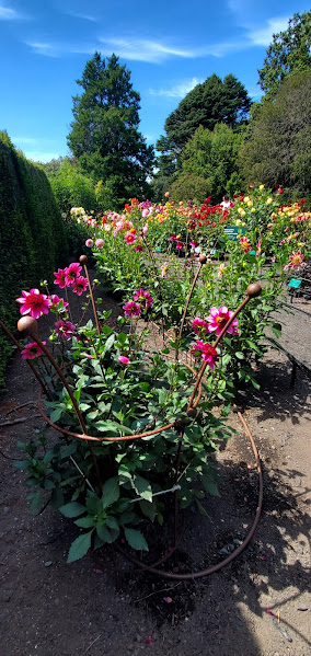
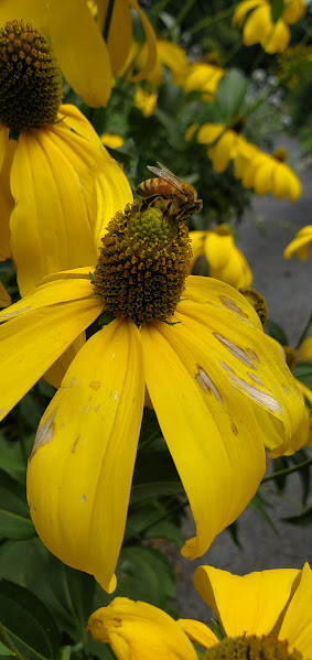
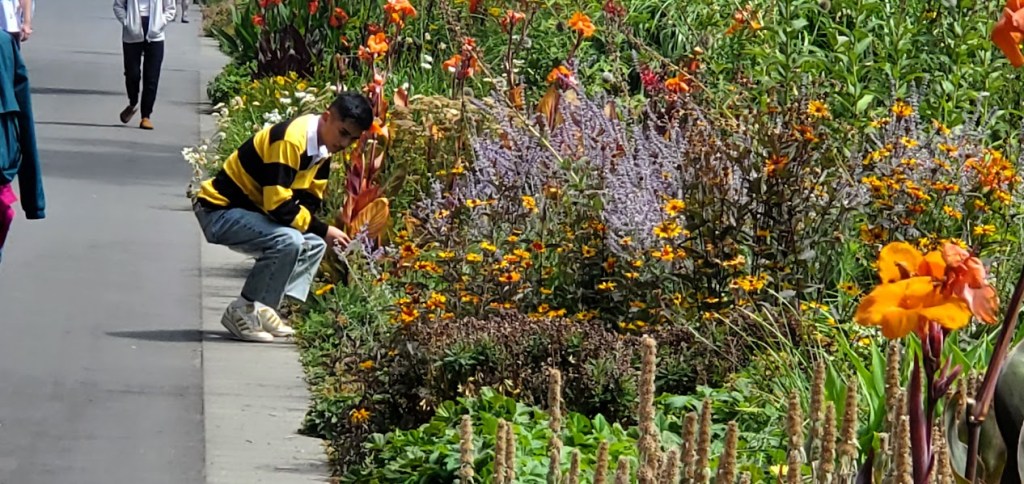
Botanical Gardens
The gardens are quite extensive with old greenhouses and ancient threes and flowers. We spent a good hour walking around.

Deryn, a fellow ITHF Member
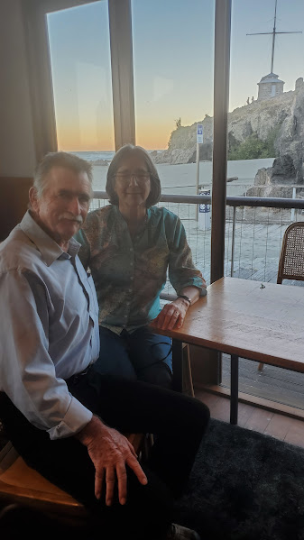
Since Rebecca had gotten Covid during the first part of our stay in New Zealand, most of our ITHF (International Travel and Hosting Fellowship) connections had to be canceled. Now that Rebecca had tested negative, we decided to follow up on the only ITHF connection that we had still scheduled.
I had contacted Deryn months earlier to see if she could host us, and she turned out to be one of the true inspirations for this part of the trip.

Deryn lives on the outskirts of Christchurch and is a Rotary member of the Christchurch Papanui Club, a little north of the city. She is a semi-retired business owner. Her son is gradually taking over her gem and mineral business, but nowadays, she spends a lot of her time hosting other Rotarians and showing them around the Christchurch area. While we had already book other accommodations, Deryn volunteered to show us around.
Deryn, a woman Woody connected through Rotary Travel and Hosting picked us up early in the morning. She drove us out to Sumner Beach and we had lunch at a Chinese restaurant. She talked about her life and the earthquake. She had lived n a suburb between Redcliff and the city. Her house and over 30 other houses were destroyed by the liquefaction after the earthquake. Her house was livable for over a year but it was sinking and developed cracks. She eventually got all her insurance money and bought land and built a new house on the other side of the city.
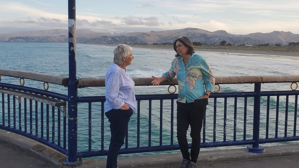
We drove out to New Brighton near her old town and walked out on a long pier. This is a sad town because of the hundreds of people that have moved away. They have a large library on the ocean, but it looks forlorn. The wind blows strong here so there are no big hotels though the beach is pretty.
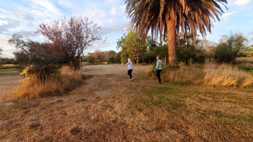
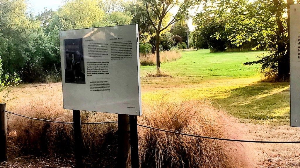
We then drove to her old neighborhood. She could find her old land by a palm tree that she had planted 40 years ago in what was her front yard. Now it is all just a field. Hard to believe that it was a community of homes.
I asked her to tell about the actual event of the earthquake, where she was, and what she did. Deryn said that although she heard a lot of the news on the television, and it was clearly a disaster, for her and her family, it was a slowly unfolding disaster. The liquefaction that oozed out of the drains and sewers made it impossible to get around the city. At her house, there were volunteers who came and helped shovel the muck away, but it left a mess everywhere, and landscaping and flower beds were ruined.
But far worse than that was the cracks in the walls and stuck doors and windows that gradually appeared. More than a nuisance, it was a harbinger of worse news to come. Some neighborhoods were labeled “green zones” and some were labeled “red zones.” Green zones were safe, but red zones meant that it was unsafe, and for Deryn, unsettling in so many meanings of the word. It meant, eventually that the homes were uninhabitable, and that she would eventually have to leave her home of 40 years.
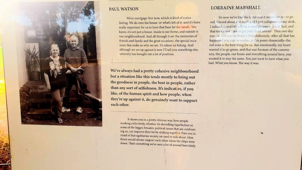
Beyond all that, her insurance issues meant lots of applications and paperwork to be filed, and hunting for another place to live. “I am really one of the lucky ones,” she told us. She was able to get full replacement value of her home and ended up with a new house in a nice neighborhood. “But the real heartbreaking part of it all was losing my neighborhood of friends, some of which were there when we first moved there 40 years ago.” Deryn told us, as she dropped us off at our rental, that nowadays, she derives most of her pleasure from showing travelers around her city. I am amazed that someone who has undergone such a difficult ordeal can remain so positive.
Earthquake Museum
After our tour, we had become numb to all the discussion of the Christchurch earthquake. But after meeting Deryn, I wanted to understand how people dealt with such a life-changing event. So the next day, of we set off for the Earthquake Museum by bus early the next morning.
With all this in mind, I started to notice that all the people seemed to have a more positive attitude than we were used to experiencing on the North Island. For example, we would be on a bus and when we got off, everyone says “Thank you” to the bus driver. Even a group of 12-14 year old boys with skateboards surprised me by each thanking the bus driver in a positive tone as they got off!
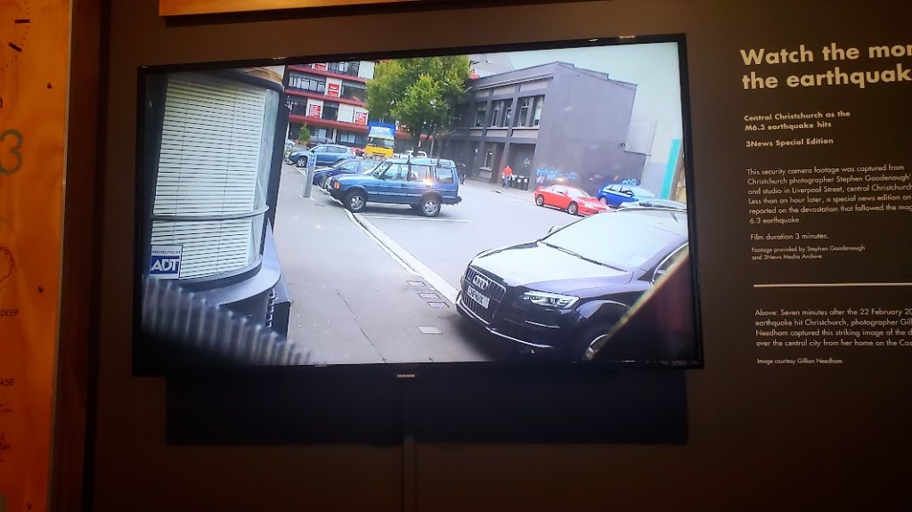
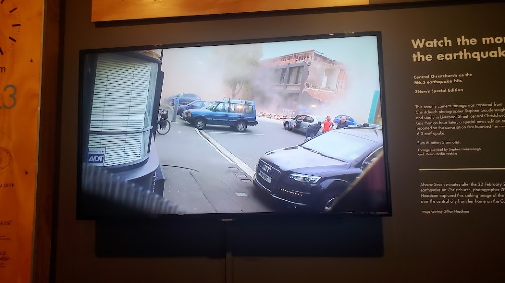
At the museum, we saw artifacts, photos, and video coverage of the earthquake. One showed a security camera that recorded the moment of the February temblor.


The created a beer at that time called 7.1 Proof, indicating both the alcohol content and the power of the earthquake. The Aftershock was actually the more damaging earthquake since it was closer to the surface. Collector items now.
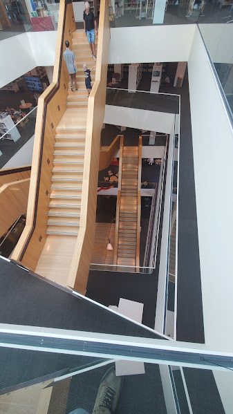
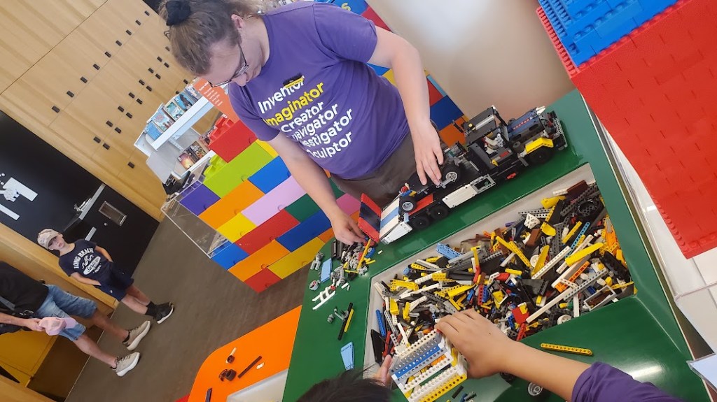
It seems that this theme of resiliency was regionwide. Everything that had to be rebuilt was done with the idea that they would make it better than before. Later at the library, we found out that the previous library was condemned, so this new one would be built in a manner that would be up-to-date, bigger and better than ever, and built to meet the needs of the modern community.
Rebecca did some reading and looked up some of her favorite authors while we visited. I took the opportunity to do one of my favorite pastimes, looking over big format photography tombs. I love seeing collections of photos from various photographers, from various eras and genres. They also had lightning-fast WiFi, so we caught up on some communications.
Final Day in Christchurch
Our last day we had was spent with Deryn. We had booked a guided trip to Akaroa with her to see dolphins and whales, and we were going to treat Deryn and she would drive us. We got an email delivered the night before stating that the whale-watching trip had to be cancelled because of heavy winds. So we decided to spend the day with Deryn doing sight seeing north of Christchurch.

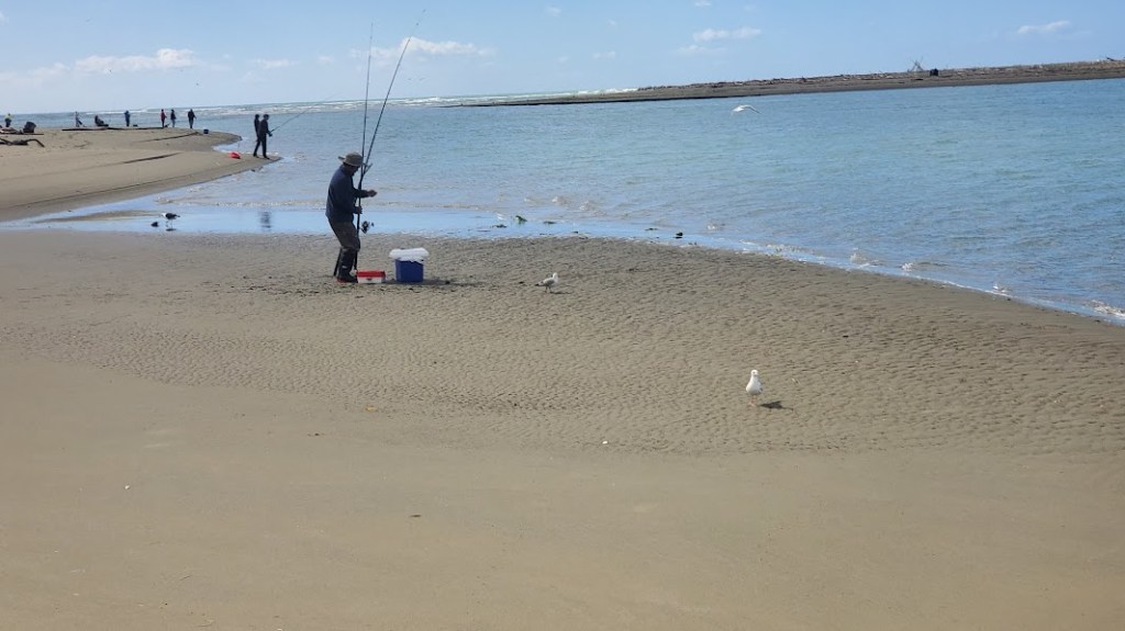
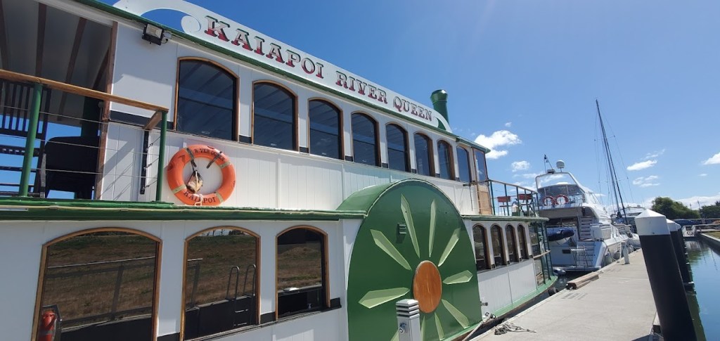
Deryn picked us up about 9:30 and we drove north around Kairaki Ban Beach. We walked up the path to he beach past a couple dozen people fishing. Where we had parked, there was a sign on a riverboat saying there was a luncheon cruise, so we decided to do it. After a walk up along the other way on the beach we boarded and sat at a sunny table behind glass. The boat took a slow turn and headed out to the confluence in the delta. The water was turquoise blue that is common here, and there were a few birds along the bank. It was a pleasant place to be. The food came. It was ham, potatoes, and coleslaw for them, and I had a veggie patty instead of ham. I appreciate the effort, but it was tasteless and had the consistency of paste. The coleslaw was good–the wine, not so much.
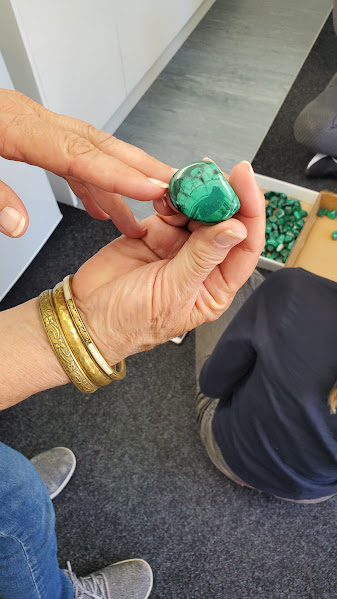
All this time we spent with Deryn, she had talked with us about her gem store that she had run. She had a retail store with a wholesale supply house as a secondary business. The gem store had been very challenging to run during Covid. So in the last couple of years, they tried to sell the business, but no reasonable offers had come in. Slowly they sold out the inventory, and just this month, they closed the retail shop.
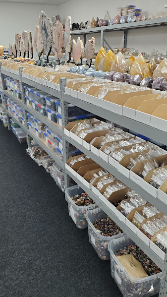
The wholesale operation, however, is still running strong. Deryn offered to take us to see the wholesale warehouse. I was very interested to see it.
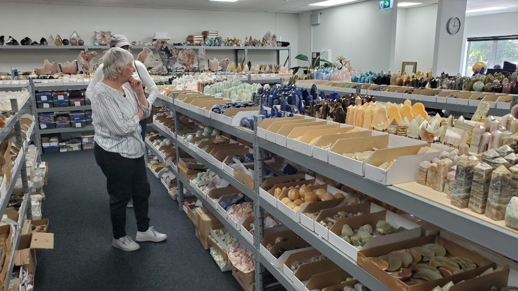
Her warehouse was huge. She must have a couple million dollars worth of inventory! Amethyst, and crystals, tiger eyes, tourmaline crystals, fossils–you name it, I bet it’s there. She was kind enough to give me a small rough topaz. It’s clear color–I didn’t know there was clear topaz. I really appreciated that she did that.
She drove us home and we thanked her for her willingness to host us. She really is a great example of what Rotary ITHF (Rotary’s International Travel and Hosting Fellowship) is supposed to be.
Deryn has become a real friend. I respect the fact that she perseveres with grit and resilience. In her Rotary Club, she seems to be one of the “quiet leaders”. Not the kind of person who wants to take on leadership positions, but one of the people who seem to be like the mortar that holds the bricks together. We really felt like Deryn was the heart of our trip to the South Island.
The next morning, we packed up and said goodbye to Chloe as we headed to the airport. We did one last tour of downtown before heading out on the airport bus. As always, we left thinking that we could easily spend much more time in Christchurch. Who knows if we’ll be able to return?

Fabulous. Thank you for sharing.
Cheers, Kim
LikeLike
TLovely memories of a beautiful country. Glad you had the opportunity to visit Christchurch. It had just suffered the earthquake when we were there in NZ (2010)and we had to cancel that stop on our adventure. Thank you for sharing!
LikeLike
What an amazing experience. Thanks for sharing. I’m sure you’ll treasure your time there. Travel safely home.
LikeLike